Clontarf Village @ Vernon Ave
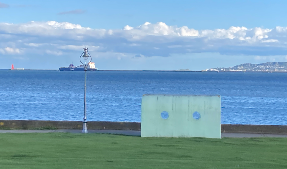
Vernon Avenue in Clontarf connects Killester to the sea, ending in a spectacular flourish opening out onto the Clontarf Promenade. That's the theory at least. In practise, the seafront end of Vernon Ave contains some awkward-to-use car parking outside Beshoff's, narrow crowded footpaths, a small car parking "lagoon" in front of The Sheds and a triangular semi-green plaza outside the pharmacy.
This is all about to change - Dublin City Council are investing in placemaking in the urban villages around the city as agreed in the Dublin Development Plan 2022-2028. As part of this work, Vernon Ave is getting a much-needed glow-up.
How it was
The photos below date from 1989 - 1990 and show an unstructured space, with no greening, no traffic lights and minimal road markings and signage. While there are lots of parked cars, it's striking how small the cars are relative to modern ones.
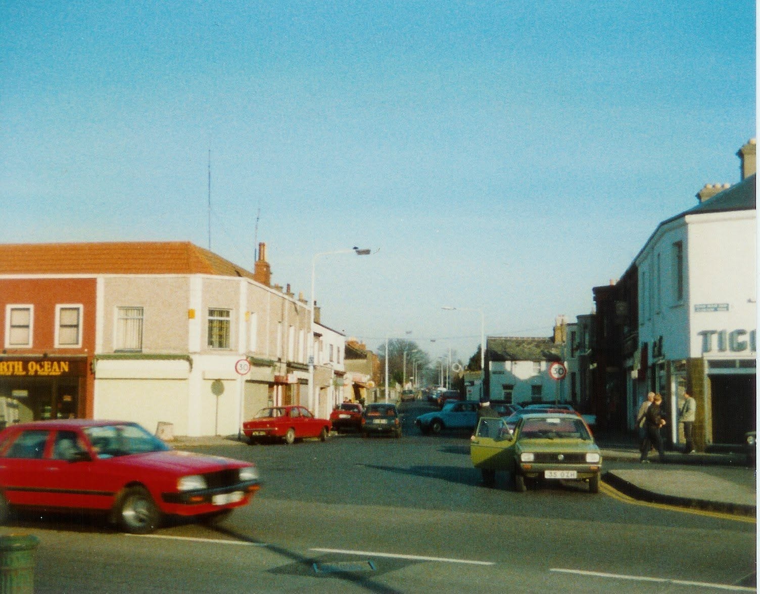
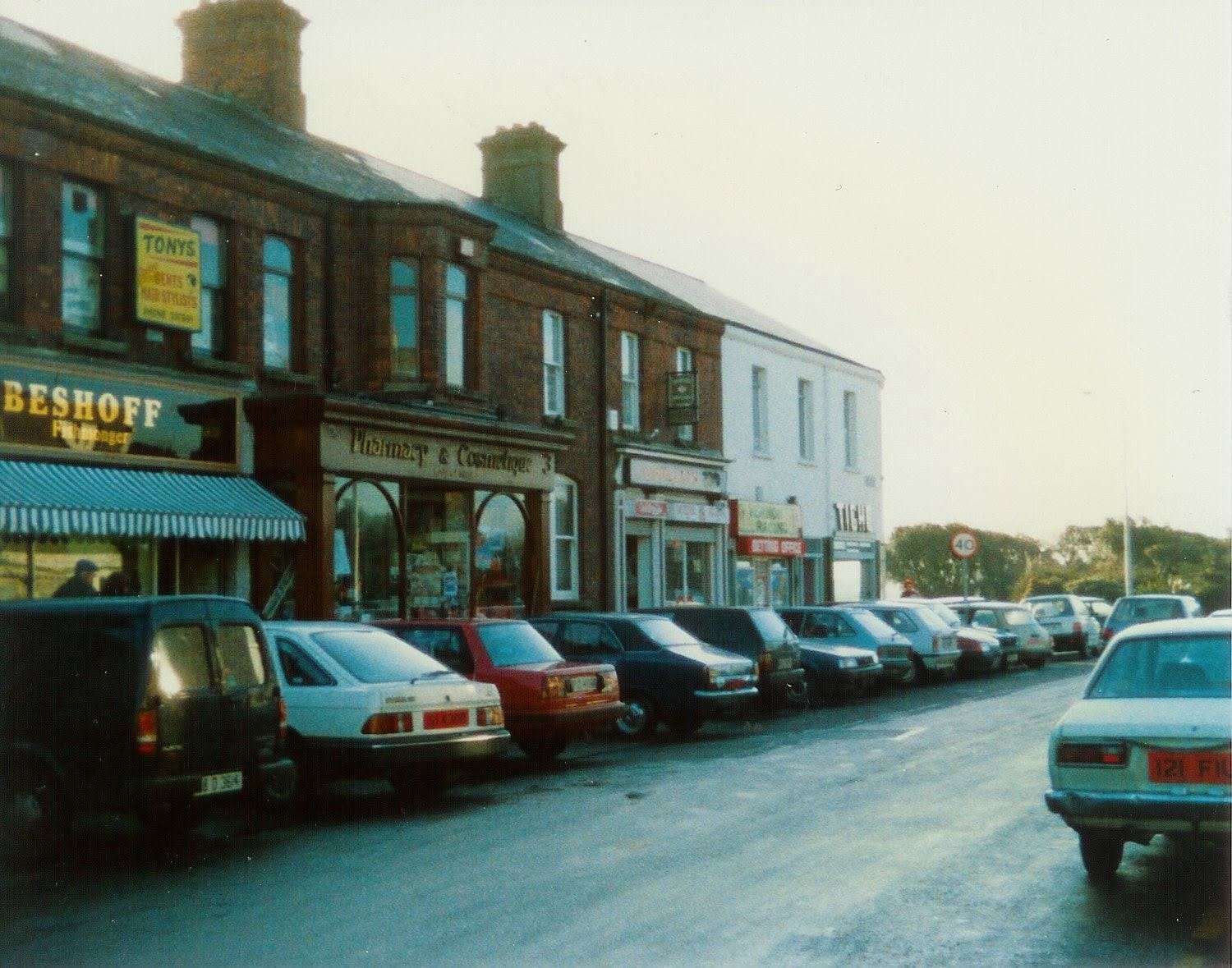
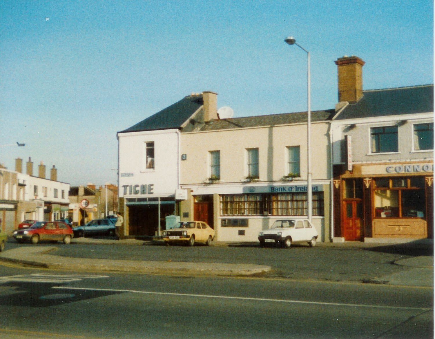
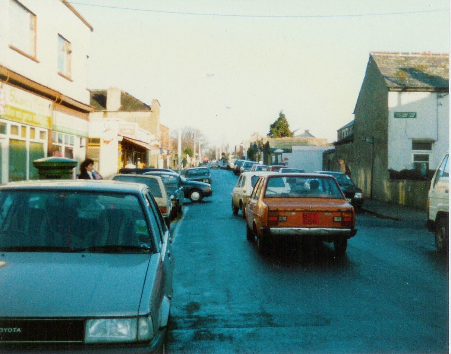
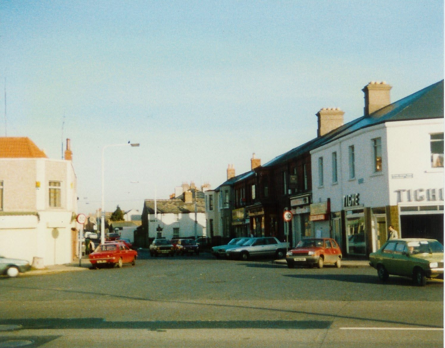
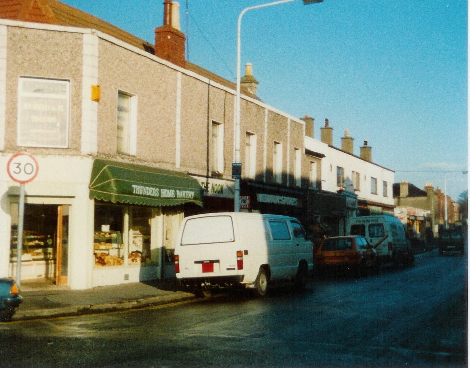
Vernon Avenue / Clontarf Road junction circa 1990
Then and now, a major pinch point for pedestrians is the space outside Beshoff's (which in those days was still a fishmonger) - at some point the original fenced-off gardens at the front of this row of buildings were removed, the footpath was realigned to hug the front of the shops, while the remaining space was reallocated for car parking.
When these pictures were taken, there were 2 car parking lagoons on the Clontarf Road - one on either side of the Vernon Ave junction. As of 2026, only the one outside The Sheds remains. This has helped make the junction easier to manage for people on foot, since cars are now coming from 3 directions and not 4, at a cost of about 10 car parking spaces.
A small aside: The contrast in speed limits then and now is striking, with 30mph (~50 km/h) on Vernon Ave and 40mph (~60km/h) on the Clontarf Road back then. Today these limits are 30km/h and 50km/h, which is far safer for everyone. Since there are 3 times as many cars on Ireland's roads now than when these pictures were taken, reducing speed limits in built-up areas was a vital mitigation measure to protect people from the hazards created by the increase in vehicle movements.
How it is now
The photo below shows the junction as it is today. The commercial area south of Clontarf Park has a 2-way through road, narrow footpaths, parking for 12 cars on the Eastern side and a line of cast iron bollards on the Western side to prevent people from parking and driving on the footpath.
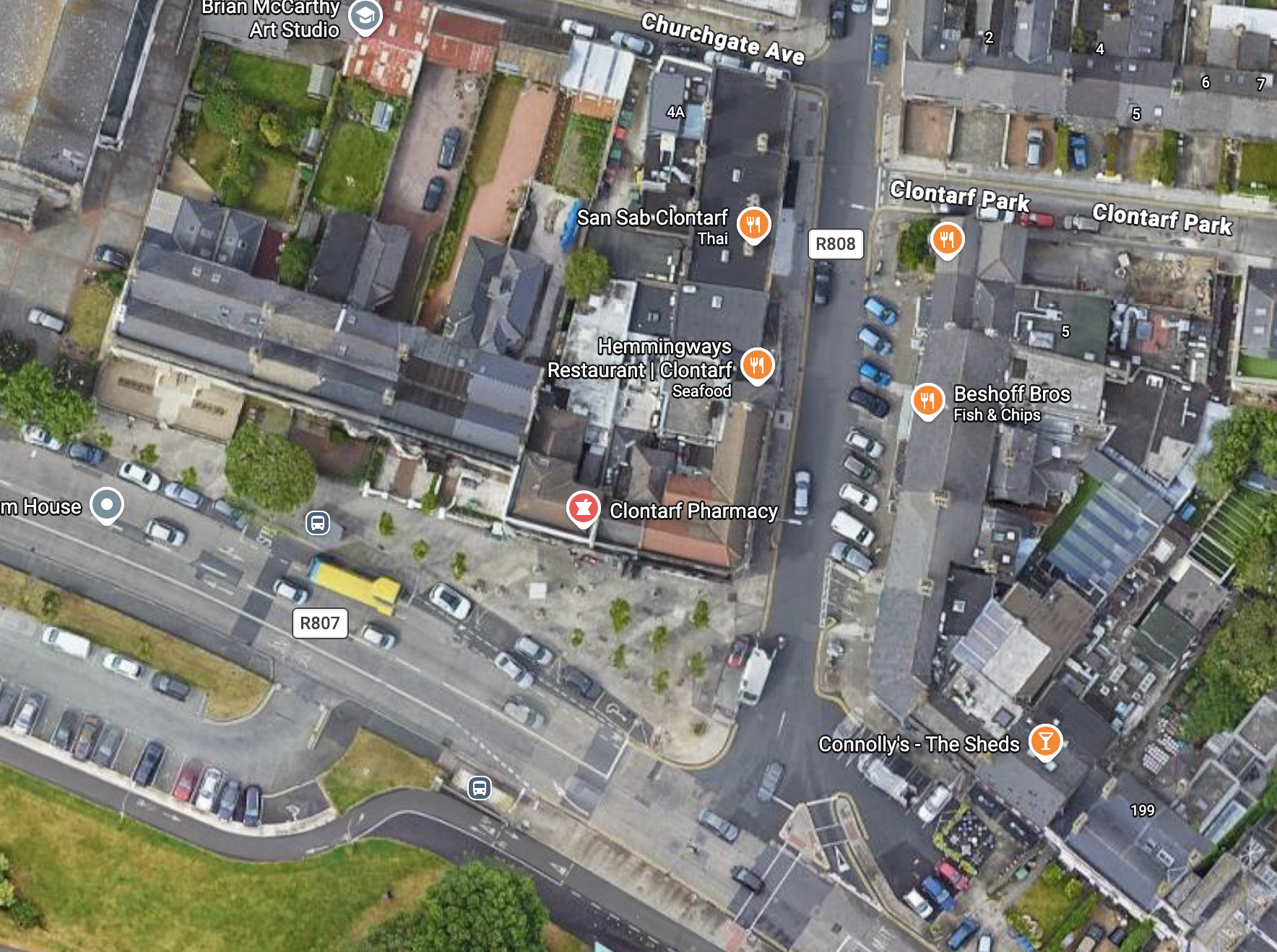
For a pedestrian to cross from the seafront on the southern side of the Clontarf Road over to The Sheds, 3 separate crossings are required - one to cross the road, one to cross the slip lane and another to get across the parking lagoon. Only the first 2 parts of the crossing are signalised, which makes the last part of the crossing somewhat fraught when there are cars moving in and out of the parking area.
I don't believe this this allocation of space works for anyone. Busy food service businesses like Beshoff's and San Sab are fronted by narrow footpaths which make them perpetually crowded and difficult to navigate for anyone in a wheelchair or pushing a buggy. The raked parking spaces are awkward to drive in and out of and cause delays for motorists who have to wait for people trying to squeeze their cars in and out of the parking spots there. For anyone trying to ride a bike up or down Vernon Ave, it's seriously hazardous - motorists reversing out of parking spaces can't see anyone on a bike due to their raked angle. Frustrated drivers waiting for the road to clear from parking cars are inclined to "floor it" to get past the pinch point, which creates its own hazards.
It's not just me who thinks the space could be used better - back in 2021 Brennan Furlong architects made a proposal called "what if?" which provided a partial reimagining of how this space might work. There are definite seeds of the "what if?" proposal in the final scheme (though the what-if scheme didn't go so far as to reallocate road space away from parking).
How it will be
The image below is an artist's visualisation of how the new scheme will look (taken from the Dublin City Council website). The paved area marked out in the tan colour is the major change, a reallocation of space from motor vehicles to people. In some ways this is a restoration of the original layout of the space, which was put in place long before the invention of the motor car created the attendant need for parking.
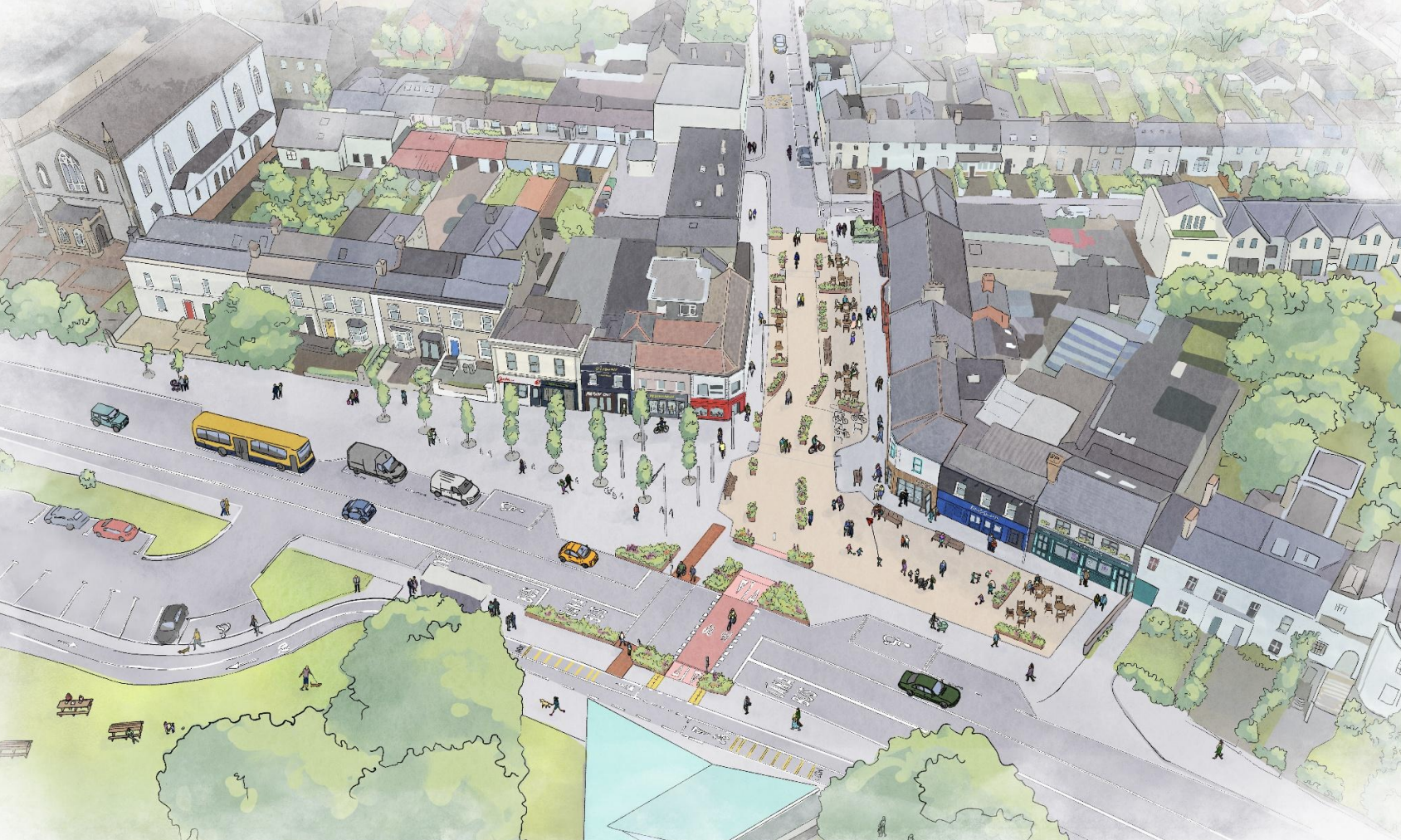
An important design feature is the pedestrian crossing (drawn in pink) across Clontarf Road. This will be a raised crossing for improved accessibility, which is welcome. Because it turns the current 3-part road crossing into a single crossing all at the same level, it creates a connection from the pedestrian plaza to the seafront to make it feel like one space running right down to the sea, instead of two separate spaces divided by a road.
Parking and driving
The image below shows the impact the new scheme will have on parking and driving.
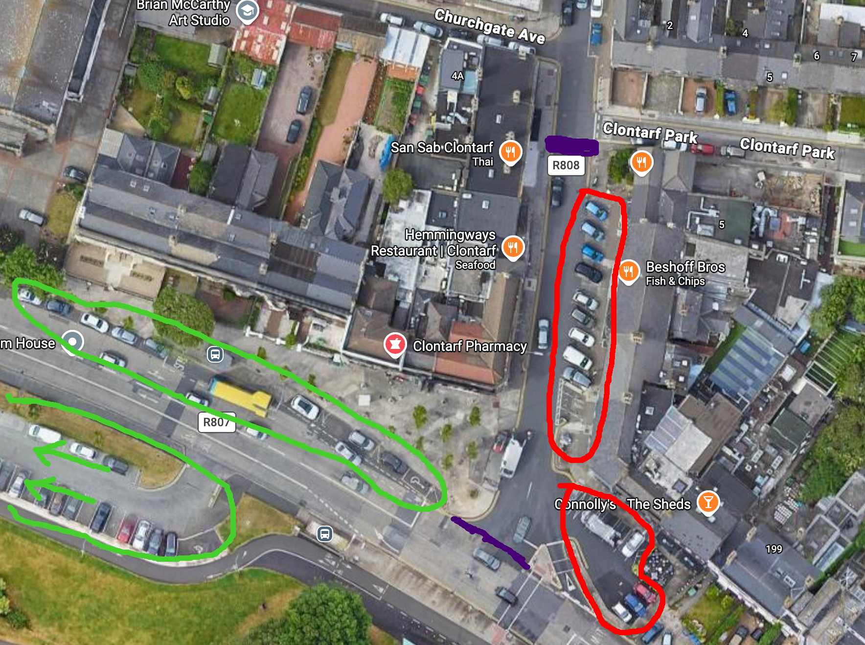
About 20 car parking spaces are to be removed (12 outside the shops and another 6-8 outside The Sheds) - these are marked in red above. The car parking areas marked in green are unchanged. As you can see, there is no shortage of parking nearby, either along Clontarf Road in front of the church or in the dedicated car park across the road. New disabled parking bays are to be placed inside the pedestrian area itself, which is good news for blue badge vehicle drivers who will now be able to bring their vehicles right into the plaza itself instead of parking out on the seafront.
The 2 purple lines represent the boundary of the new pedestrianised area. There will be filtered permeability at the north end so it's possible to walk, wheel or cycle from Vernon Avenue into the new plaza. There will no longer be through traffic for motor vehicles - the are will be pedestrianised as far as the lower purple line.
The biggest impact on drivers will be on people coming out of Clontarf Park, which is one-way going towards Vernon Ave. At present, it's possible to turn either left towards the seafront or right towards Nolan's. After this scheme is delivered, there will be no more vehicle access to the seafront and only the right turn will be allowed. This is likely to cause some disruption while the changes bed in. However, over time I expect "traffic evaporation" to drastically reduce traffic on the southern end of Vernon Ave (we have seen this already in Dublin, for example when filtered permeability was installed at Grangegorman). This will be hugely positive for local residents, who will benefit from reduced noise, improved air quality and enhanced pedestrian safety.
Conclusion
I'm in favour of this scheme for the reasons outlined above. I have had many contacts from members of the public about it and I'd like to thank everyone who took the time to engage with the process and contact their local representatives about this change. I'll write another article on how the planning and public consultation process works, as judging by last week's North Central Area meeting there seems to be some confusion (genuine or confected, you decide!) as to how projects like this get approved and delivered.